For Savoie and Northern French Alps
Fantastic skiing available but many people are taking crazy risks, please read
On Monday 4th February we picked up reports of 10 people caught in 4 separate accidental slab avalanches (‘accidental’ means they were triggered by people) in Val d’Isère alone. The avalanches took the victims for big, potentially dangerous rides. There were no people taken in natural avalanches. Most of these accidental avalanches were not made public because, thankfully, no one was seriously hurt. But this incident on Super Arcelle was publicised. Two skiers were caught in a slide triggered by two different skiers above them. One skier was buried, both survived.
If you go onto or close to slopes steeper than 30 degrees on a bluebird powder day straight after fresh snowfall that has fallen onto a weak layer (like we have now) you are risking this happening. Remember that 90 to 95% of all avalanche victims trigger the avalanche themselves or someone in their group does.. and increasingly other people trigger it from above like in this incident.
The most serious incident took place in Courmayeur where 4 skiers were killed in a major avalanche accident. There were a further 4 skiers killed in other incidents in Italy. We do not have any detailed information on this. But it will be related to the fresh snowfall on a weak layer.
The current instability is persisting after the first bluebird day. on 6th Feb There was a big slide triggered off the Lores in Val d’Isere. This ran into the valley that forms the exit to the Tour de Charvet.
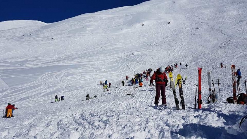
All of these incidents are unnecesary. There is an alternative. This is what team HAT were doing this week.
The great news is snow conditions are excellent. There’s plenty of great off-piste skiing to be had, as long as you keep in mind that there is still some instability due to the persistent weak layer in the snowpack.
We’ve been experiencing some fantastic powder snow over the last week. Snow-depths are great for the time of year. With so much popularity in off-piste skiing and touring, many places have been getting tracked out very quickly. We’re needing to start walking again to find any clean snow. Even just a short walk helps though. More fresh snow is expected especially on Sunday and Monday.
Best snow and biggest risk is cold north facing slopes
The best quality snow is on high-altitude north facing slopes. These cold slopes shaded from the sun are where the best snow (lovely cold powder) is to be found. Unfortunately, they’re also where that persistent weak layer in the snowpack will carry on being a problem, quite possibly until the end of the season.
On sunnier slopes there is often a surface crust in the morning, following melting by day and re-freezing overnight.
The weak layer persists
There is a significant weak layer due to the prolonged cold weather in January. This is being confirmed daily by the reports from the mountain professionals. We have experienced a remarkable period of temperatures around -20C to -30c on the higher slopes, especially in the long January nights. This extreme cold has rotted and degraded a layer of snow that sits under the new snow.
This snow test was done yesterday on the Mont de la Guerre above Champagny (La Plagne). This shows the weak layer is present and active. the snowpack is fragile.
Off-piste weather forecast for 7 to 15 Feb:
THURSDAY NIGHT 7 Feb
After the snowfall stops in the evening it will be partially starry.
Lower temperatures -7 ° C to 1000 m, -10 ° C to 2000 m, -13 ° C to 3000 m.
Above 1700 m, less than 5 cm of dry snow is expected in Haute Maurienne, and part of Haute Tarentaise and Maurienne, 5-10 very locally 15 cm elsewhere.
FRIDAY 8
Partially sunny. Frequent passages of very high clouds, sometimes dense, plus cloudy passages lower and a little thick, especially after noon, which sometimes cling to the highest peaks.
At the end of the night, cloud cover spreads from to the Italian border, very weak showers.
Snowflakes from 1200-1500 m, Above 1700 m, we expect less than 5 cm of dry snow, very locally a little more.
The very high mountain wind, from NNW locally high above 3500 m in the morning, weakens rapidly and turns NW to West during the day, then becomes strong at night.
Isotherm 0 ° C rising in the day around 2300 m, falling at night around 1700 m.
Isotherm -10 ° C rising to 4000 m, then falling at 3400 m.
SATURDAY 9
Cloudy mountains in the morning which give light snow towards 1000-1200 meters then clearings return the afternoon with a drier time. Isotherm 0 is located around 1700 meters. Westerly winds blow to 30-50 km / h on the summits.
SUNDAY 10 AND MONDAY 11 FEBRUARY
Sunday morning, the weather will be disturbed. Snow will increase during the day. Maybe showers will alternate with thunderstorms. On Monday, precipitation will continue to progress, easing. Possibly 20 to 40cm snow. Maybe more in places.
TUESDAY 12 AND WEDNESDAY 13 FEBRUARY
On Tuesday, snow will continue to affect to a lesser extent the Alps and will dissipate Wednesday.
THURSDAY 14 AND FRIDAY 15 FEBRUARY
Thursday and Friday, the weather should remain generally dry and slightly cloudy after dissipation of some morning fogs.
Tip of the week
Often nothing happens. Alain Duclos estimates that for every 100,000 turns on avalanche sensitive snow slabs, only 2 or 3 of those turns will trigger a slide. So often nothing happens. But that does not mean we can be complacent. When a slide happens it is often fatal at least very serious. Quite a lot has been happening with many slides reported this week. This will continue next week as we get more snow.
Referring to our HAT framework (below) helps keep your mind sharp by reminding you to apply risk reduction measures to make your off-piste skiing safe.
With this weak layer, if you are not sure, stay off and stay away from slopes that are steeper than 30 degrees.